

| Home | Communities | Accommodations | Places To Go | Things To Do | Site Map |
|
Glacier Country
Central Montana
Missouri River Country
Southwest Montana
Yellowstone Country
Southeast Montana
|

Boulder Creek TrailWise River MontanaListing Type: National Forest TrailCity: Wise River Montana Region: Southwest Montana 406-832-3178 http://www.fs.fed.us/r1/b-d/ | 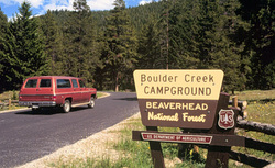 More Images |
Boulder Creek Trail is a secondary trail going up Boulder Creek. It is steep after the first 0.5 mile. It ties in with the Gold-sheep Trail 43 which provides access to forest areas to the north and south of Boulder Creek loop hike can be accomplished by hiking north on Trail 43 1.5 miles to Fourth of July Creek and back to the trailhead following the Fourth of July Trail. This trail is steep and rocky in the last mile before the trailhead.
Length: 1.0 miles.Trail Begins: Boulder Creek Road 484.Trail Ends: Trail 43
Area Map: Beaverhead-Deerlodge National Forest Visitors Map .USGS Map1: Stine Mountain.Township 2S; Range 12W; Section 22
Directions: The trail access is a short road to the trailhead at the south exit of Lodgepole Campground along the Pioneer Mountains Scenic Byway. It is 12.4 miles south of Wise River on Pioneer Mountains Scenic Byway.
Boulder Creek Trail
Beaverhead-Deerlodge National Forest, Wise River, MT 59762
|
A source for Montana Travel & Tourism Information
![]()