

| Home | Communities | Accommodations | Places To Go | Things To Do | Site Map |
|
Glacier Country
Central Montana
Missouri River Country
Southwest Montana
Yellowstone Country
Southeast Montana
|

Thompson Hellgate TrailTownsend MontanaListing Type: National Forest TrailCity: Townsend Montana Region: Southwest Montana 406-266-3425 http://www.fs.fed.us/r1/helena/ | 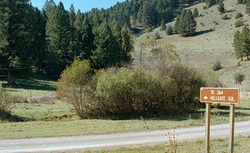 More Images |
The Thompson Hellgate Trail is open to motorbikes.
Length: 5.0 miles.Trail Beginning: Forest Road 359.Trail End: Forest Road 693
Area Map: Helena Forest Visitor Map .USGS Map1: Whites City.USGS Map2: Canyon Ferry.Township 11N; Range 2E; Section 8
Directions: Travel east from Townsend on US Highway 12 for 2 miles, then north on State Highway 284 for approximately 20 miles to Avalanche Gulch, Forest Road 359, then east for 11 miles to the Thompson Creek Junction and the trailhead.
Thompson Hellgate Trail
Helena National Forest, Townsend, MT 59644
|
A source for Montana Travel & Tourism Information
![]()