

| Home | Communities | Accommodations | Places To Go | Things To Do | Site Map |
|
Glacier Country
Central Montana
Missouri River Country
Southwest Montana
Yellowstone Country
Southeast Montana
|

Lewis and Clark National ForestGreat Falls MontanaListing Type: National ForestCity: Great Falls Montana Region: Central Montana 406-791-7700 http://www.fs.fed.us/r1/lewisclark | 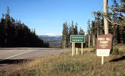 More Images |
The Lewis and Clark National Forest is divided into the eastern half known as the Jefferson Division and the western half known as the Rocky Mountain Division.
The Jefferson Division or Eastern half lies to the east and south of Great Falls and is surrounded by private and other federal and state lands. The Jefferson Division is comprised of six mountain ranges which are:.
The Highwood Mountains - northeast of Great Falls
The Crazy Mountains - southwest of Harlowton
The Little Belt Mountains - southeast of Great Falls
The Castle Mountains - southeast of White Sulphur Springs
The Big Snowy Mountains - south of Lewistown
The Little Snowy Mountains - east of the Big Snowy Mountains
The Jefferson Division land is characterized by open grassland parks along ridges with scattered timber. Rugged, rocky crests with prominent cliffs and slopes mark the entire area. It is well-forested with Douglas-Fir, Lodgepole Pine and Ponderosa Pine. Spruce and Fir types dominate the upper of the mountains.
The Rocky Mountain Division or western half extends south of Glacier Park and east from the Continental Divide. The Rocky Mountain Front is where the mountains meet the plains and you can enjoy some of the most beautiful mountain country in the west. This strip of rugged, scenic mountain terrain extends from the Continental Divide of the Great Plains, and from Marias Pass and Glacier Park to the Dearborn River. Relentless rivers have etched narrow approach entrances through the many barrier ridges. Primary access routes to this division are along the Teton River, west of Choteau and along the Sun River and Wood-Ford Creeks west of Augusta. Elevations on this portion of the Lewis and Clark Forest range from 5,000 to 9,000 feet.
Directions: The Lewis and Clark National Forest is divided into the eastern half known as the Jefferson Division and the western half known as the Rocky Mountain Division
.The Jefferson Division or Eastern half lies to the east and south of Great Falls and is surrounded by private and other federal and state lands. The Jefferson Division is comprised of six mountain ranges which are: The Highwood Mountains - northeast of Great Falls; The Crazy Mountains - southwest of Harlowton; The Little Belt Mountains - southeast of White Sulphur Springs; The Big Snowy Mountains - south of Lewistown; The Little Snowy Mountains - east of the Big Snowy Mountains.
The Jefferson Division land is characterized by open grassland parks along ridges with scattered timber. Rugged, rocky crests with prominent cliffs and slopes mark the entire area. It is well-forested with douglas fir, lodgepole pine and ponderosa pine. spruce and fir types dominate the upper of the mountains
.The Rocky Mountain Division or western half extends south of Glacier Park and east from the Continental Divide. The Rocky Mountain Front is where the mountains meet the plains and you can enjoy some of the most beautiful mountain country in the West. This strip of rugged, scenic mountain terrain extends from the Continental Divide of the Great Plains, and from Marias Pass and Glacier Park to the Dearborn River. Relentless rivers have etched narrow approach entrances through the many barrier ridges. Primary access routes to this division are along the Teton River west of Choteau and along the Sun River and Wood-Ford Creeks west of Augusta. Elevations on this portion of the Lewis and Clark Forest range from 5,000 to 9,000 feet.
Lewis and Clark National Forest
1101 15th Street North, Great Falls, MT 59403
|
A source for Montana Travel & Tourism Information
![]()