

| Home | Communities | Accommodations | Places To Go | Things To Do | Site Map |
|
Glacier Country
Central Montana
Missouri River Country
Southwest Montana
Yellowstone Country
Southeast Montana
|

Continental Divide TrailPhilipsburg MontanaListing Type: National Forest TrailCity: Philipsburg Montana Region: Southwest Montana 406-859-3211 http://www.fs.fed.us/r1/b-d/ | 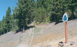 More Images |
The mileage shown below for Continental Divide Trail includes only that portion located on the Philipsburg Ranger District.
Length: 13.8 miles.Trail Begins: Goat Flat.Trail Ends: Pintler Pass
Area Map: Deerlodge National Forest Visitors Map and Anaconda Pintler Wilderness Map .USGS Map1: Warren Peak.USGS Map2: Storm Lake.Township 4N; Range 14W; Section 36
Directions: From Philipsburg go south on Highway 1 for 16.2 miles, then south on Forest Service Road 675 for 7 miles to Storm Lake, then south on Trail 41 3.5 miles to Goat Flat.
Continental Divide Trail
Beaverhead-Deerlodge National Forest, Philipsburg, MT 59858
|
A source for Montana Travel & Tourism Information
![]()