

| Home | Communities | Accommodations | Places To Go | Things To Do | Site Map |
|
Glacier Country
Central Montana
Missouri River Country
Southwest Montana
Yellowstone Country
Southeast Montana
|

Boulder Lake TrailEureka MontanaListing Type: National Forest TrailCity: Eureka Montana Region: Glacier Country 406-296-2536 http://www.fs.fed.us/r1/kootenai/ | 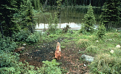 |
Boulder Lake Trail (62) leads to Boulder Lake. The hike to the lake is on a relatively gentle grade, while the remainder of the trail to its junction with Trail 91 has a steeper grade with a number of switchbacks. Portions of Trail 91 have not been maintained for some time. Primitive campsites can be found on the east end of the lake. Huckleberries ripen along the trail in mid-August. Use caution; watch for moose and grizzly bears.
Length: 1.0 miles. Easy to moderate difficulty, moderate use
Trail Begins: Road 7229.Trail Ends: Boulder Lake
Area Map: Kootenai National Forest Visitors Map .USGS Map1: Boulder Lakes.Township 36N; Range 30W; Section 36
Directions: From Highway 37, cross Koocanusa Bridge and travel north on FDR 470 for 2.3 miles. Turn on Boulder Creek Road 337 and travel for 10 miles to Road 7229. Turn and follow 1.2 miles to the trailhead.
Boulder Lake Trail
Kootenai National Forest, Eureka, MT 59917
|
A source for Montana Travel & Tourism Information
![]()