

| Home | Communities | Accommodations | Places To Go | Things To Do | Site Map |
|
Glacier Country
Central Montana
Missouri River Country
Southwest Montana
Yellowstone Country
Southeast Montana
|

Rosebud Battlefield State ParkDecker MontanaListing Type: State ParkCity: Decker Montana Region: Southeast Montana 406-232-0900 http://fwp.state.mt.us | 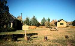 More Images |
Site of the June 17, 1876, battle between the Sioux and Cheyenne Indians and General George Crook's cavalry and infantry. One of the largest Indian battles ever waged in the United States, it set the stage for the Indian victory eight days later when Lt. Col. George A. Custer and his immediate command were wiped out on the Little Bighorn. This large 3,052 acre park at 4,300 feet in elevation restricts the use of metal detectors, digging, collecting or removal of artifacts and bikes are allowed on existing roadway only. The leash law for pets is in effect from 4/1 until the opening day of upland bird season. Visitors must watch for rattlesnakes in this area. The area is undeveloped and is adjacent to the Crow Indian Reservation. Sheridan, Wyoming is 46 miles to the southeast.
Directions: Rosebud Battlefield State Park is located 25 miles east of Crow Agency on US 212, then 20 miles south on Secondary 314, then 3 miles west on county road. Or 5 miles north of Decker on Secondary Road 314, then 3 miles west on county road.
Rosebud Battlefield State Park
Montana Department of Fish Wildlife and Parks, Miles City, MT 59301
|
A source for Montana Travel & Tourism Information
![]()